Chart (Map) of the Wash – 1693
£4.50One of two maps and a chart of Boston available. Surveyed by C. Merit in the Mayorality of Henry Bell (of King’s-Lyn). Approximately 36cm (14.25″) x 46.5cm (18.25″). Dated…
Reproductions of maps from a Chart of the Wash dated 1643 to the earliest known authentic map of Boston (1741). Also a series of prints of watercolour paintings by Margaret Brough, surrounding a short verse, one for each month of the year. Each of these are suitable for framing and make ideal gifts.
Showing all 5 results

One of two maps and a chart of Boston available. Surveyed by C. Merit in the Mayorality of Henry Bell (of King’s-Lyn). Approximately 36cm (14.25″) x 46.5cm (18.25″). Dated…

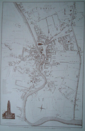
One of three maps of Boston available. Hall’s Map of Boston – 1741 Surveyed by Robert Hall. This is the earliest known authentic map of the town and the path…

One of three maps of Boston available. Surveyed by John Wood, land surveyor of Scarborough and engraved by T. Gent of Edinburgh. Approximately 36.5cm (14.4″) x 55.2cm (21.7″). Please note…
This volume looks at: Lincolnshire’s Archaeology from the Air Presented as a collection of papers, it is a new departure for the National Mapping Programme. Much of the landscape of…

Guernsey is the second largest of the Channel Islands and is just over 30 sq miles in size with a population of around 65,000. It has its own currency of…
End of content
End of content